 Shown above and in the photos below, the largest and hottest flowing lava was right off the end of highway 130 yesterday; flowing vigorously between two posts that were the entrance to several properties beyond, including the home recently lost to lava (The shell of that home can be seen in the distant middle-right in the larger view size)
As the lava rivers came near the highway, only a handmade sign defining what a ‘Lavatic Fringer’ is remained next to the side access road that had led to the home lost to lava.

 Below is the sign as it was before, and the house still standing in the distance.
 These signs were created by the owner of the nearby property and I was told, were to get people to think, especially lava watching visitors.
 Above: Two hours later, in the pouring rain, we can see how inflated and advanced the lava is by using those entrance gate pipes as a guide. ( I can not explain the barbecue sitting on top the inflating lava)
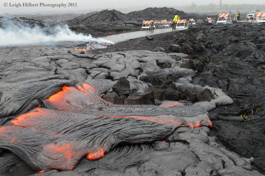 By 2:00 PM the Janguard lava viewing security personnel had arrived and were repositioning the barricades for the night.
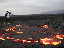
 Meanwhile down along the shoreline I found molten lava dribbling off the cliffs to the ocean.
 This was all that remains of the western lobe ocean entry from weeks ago.
Below- Eastern entry:
 At 1:30 PM yesterday lava was also advancing to within 25-feet of the ocean much further east and out over the west end of the July25-Dec 1st lava delta, right off the old Ulua fisherman’s road and where I filmed that lava delta collapse November 2nd .
 I would assume lava would be meeting the ocean by today, even yesterday large waves were splashing on the molten lava at times creating steam. Judging by the lava volume and movement, this would likely also be a very weak ocean entry unless some more thrust from the supply system finds this area.
Speaking of the supply system, the first pronounced deflation in some time is being recorded by the Kilauea Summit and Pu`u O`o radial tilt meters:

USGS/HVO has posted some new photos and information on their images page They have some great shots of the Pu`u O`o crater lava activity, including a forming spatter cone on the crater floor – click on the link above and check it out.
Below are two images from the USGS images page that I have added a few notes to, showing where the photos of lava I post above were taken and other landmarks in the field.
 Click on these photos for a nice large size
I will not likely be posting any new updates until early next week, unless something radically changes on the coastal plains lava flow.
Hawaii County Civil defense continues a seven days per week public lava-viewing site that is managed by Janguard Security off the very end of Highway 130 in Kalapana Gardens vicinity. You can get on site updates by calling after 2:00 PM until 10:00 PM daily: 430-1966, or the main hotline: 961-8093


No comments:
Post a Comment