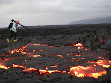
>The Waikupanaha ocean entry molten lava, which began entering the ocean exactly twenty months ago today, stopped flowing this week for the longest period within that time frame.
>Some of the highest levels of sulfur dioxide emissions within the Volcanoes National Park and beyond have been recorded this past week. (At the launch of Volcano Month, Jan. 1st, Park staff greeted people arriving wearing serious gas masks and asked visitors not to get out of their vehicles!)
>Unusually prolonged cessation of the Big Island’s normal northeast Trade Wind has caused the extra intense volcanic laze/haze - vog, to lie heavily over portions of the island and beyond that normally would seldom see these affects - for every day since the New Year began.
And now on day seven of this New Year 2010, these listed conditions continue.
What could also be added to this list of oddities above is the pronounced divergence of recorded magma reservoir pressures under our favorite volcano; Kilauea:

Look at these two lines on the graph; see how they completely diverge: one rapidly heading up, the other down. Though this has happened in the past, they usually converge rather quickly, therefore reflecting the unison of magma pressures moving up or down below the volcano. Each line represents a different location on the volcano. It is important to know what the graphs represent for us to try to understand the significance of this divergent event and also how it affects the molten lava usually seen coming down the mountain and entering the ocean:
Deformation tiltmeters strategically placed on Kilauea Volcano, specifically at Uwekahuna (UWE), on the northwest rim of Kilauea’s caldera, and 13 miles east at Pu`u `Ō `ō crater (POC), on the northwest flank of the active vent along the east rift zone, record radical tilt
Deformation, also known as Inflation/Deflation (D/I ), is described in its simplest form here.
If this radical diversion continues, it may indicate some great radical change in this volcano; manifesting in unknown ways. But results of these changes are already showing themselves. Last night when I returned from displaying my volcano photos at the end of highway 130 – the Hawaii County lava viewing area, I took a look at three important volcanic links: The Deformation tiltmeters, Halema’uma’u Jaggar Museum web cam, and the Halema’uma’u overlook web cam
Below are each of those cams as I saw them at 10:38 PM last night (and how they look this morning)—each showing the strongest lava glow recorded on those two cams that I have ever seen there:
 Last night at 10:38PM Jaggar cam.
 This moning's view from the same location.
 Last night at 10:38 PM from the closer overlook cam: a broiling lake of lava.
 This morning from the same overlook cam at 11:00 AM-- Seeing daytime lava is rare for this cam.
Anyone at the Jaggar museum overlook last night enjoyed a good show.
Lava viewing area tonight:
It would seem unlikely we will have any visible lava within eyesight at the Civil Defense lava viewing area tonight, though an up-tic in lava pressure as I wrote this sentence
 may indicate a chance of visible lava later tonight—a chance….. We do have favorable light NE Trade breezes this morning, but we do not have molten lava flowing strong enough to be witnessed at the viewing area at this time. There is lava moving out along the original lava tubes, but too far away to be seen. These new surface flows could, though, become more visible tonight.
The best lava show at the moment will be the Halema’uma’u as seen from the Jaggar Museum overlook balcony. The park is open all night and is free after dark.


No comments:
Post a Comment